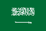
Saudi Arabia - Its Geography
The Kingdom of Saudi Arabia occupies about 80 percent of the Arabian peninsula. It is 14th largest state in the world.
Saudi Arabia's geography is varied. From the humid western coastal region on the Red Sea, the land rises from sea level to a peninsula-long mountain range (Jabal al-Hejaz) beyond which lies the plateau of Nejd in the center. The southwestern 'Asir region has mountains as high as 3,000 m (9,843 ft) and is known for having the greenest and freshest climate in all of the country, one that attracts many Saudis to resorts such as Abha in the summer months. The east is primarily rocky or sandy lowland continuing to the shores of the Persian Gulf.

|

|
|
Capital
|
Riyadh
|
|
Area
|
2149690 Sq Kms
|
|
Population
|
27136977
|
|
Official Language
|
Arabic
|
|
Currency
|
Saudi Riyal (SR)
|
|
Country Code
|
+966
|
|
Internet TLD
|
.sa
|
|
Drives on the
|
Right
|
|
Time Zone
|
GMT (UTC+3)
|